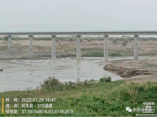
On July 29, 2022, the Lop Nur scientific expedition team, which is organized by the China Biodiversity Conservation and Green Development Foundation (CBCGDF) in 2022, carried out a hydrological survey of the lower reaches of the Andir River and its surrounding areas.
The Andier River is a river that is mainly recharged by spring water overflowing from groundwater throughout the year, and its flow change process is directly affected by seasons. Summer is the wet season, and the water volume changes significantly during the wet and dry season.

The Yeyike River originates from the northern slope of Kunlun Mountains, with melting snow as its source. After exiting the Yeyike Mountain Pass, it turns northeast and joins with the Yulukun Prague Mountain Stream. The total length of the river is about 90km, and the drainage area is about 238 square kilometers. The annual runoff is seasonally strong, mainly concentrated in May-August, and the downstream is cut off in other months. The comprehensive hydrology team measured the flow velocity of the river at the No. 1 point of Yeyike River (82.8741 E, 37.1852 N), and observed that the river bed was sandy, with obvious scouring marks on both sides, reeds and small water flow.

The Yatungus River is an important surface water source and is connected with the surrounding groundwater system. Together with the Niya River and the Andir River, it is a river formed after the groundwater is discharged in the form of a spring. The comprehensive hydrology team measured the flow velocity of the river at No. 1 point (83.1843 east longitude, 37.3266 north latitude) of the Tunguska River. It was observed that the river bed was sandy, the river erosion was obvious, the water flow was large, the water was shallow, and the river surface was wide. Reeds are lush on both sides.

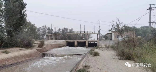
Finally, the scientific expedition team came to the sub-sluice gate of the Revolutionary Canal of the Qarqan River. The Qarqan River originates from the north slope of Muztag Peak at an altitude of 6973m in the Kunlun Mountains. The flow direction is "S" shape, with a total length of about 813km and an average annual runoff of about 5.62×10⁸m3. It is the only one in the southeast of the Tarim Basin with a large water volume. the river. The topography of the Qarqan River Basin is composed of four geomorphic units, namely high mountains, mid-mountain belts, alluvial-proluvial fan plains and deserts. Revolutionary Canal Station is located on the alluvial-proluvial fan plain. According to local staff, the flow of the canal this year is smaller than in previous years, and there has been no flood. The possible reason is that the upstream precipitation or glacial meltwater has decreased, or it may be affected by the water storage of the Dashimen Water Control Project. The exact reason It will be determined after data analysis.
Original Chinese Article:https://mp.weixin.qq.com/s/kP8eXOCgT2A2tUt9mOFDYw
Translator: Daisy
Checked by: Lucy
Editor: Sara
Contact: v10@cbcgdf.org; +8617319454776

Contribution
Do you know? CBCGDF is a non-profit organization. We rely on crowd-funding and donations. You have the opportunity to help us to advance biodiversity conservation. Donate TODAY to power up the movement to make it a better world for all life.
https://www.paypal.me/CBCGDFChina
http://www.cbcgdf.org/English/ConfirmDonaTion/0.html
