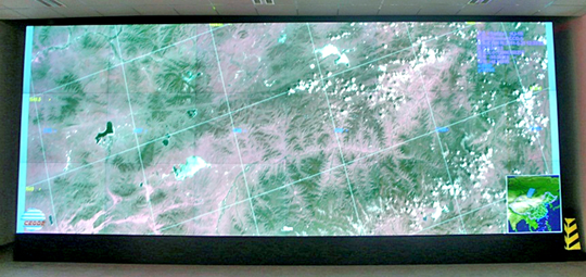
Recently, the “Satellite Quick View Data Service System”, which is one of the core contents of the “Ulan Chab City Ecological Civilization Construction Planning Project” undertaken by China Biodiversity Conservation and Green Development Foundation (CBCGDF), has been installed and put into operation at the Ecological Environmental Protection Bureau of Ulan Chab.
The software system realizes real-time moving window display and information broadcast of remote sensing data, and pushes the fast-view images of various remote-sensing satellite sensors received by the satellite ground station to the remote user in real time, so that users can obtain satellite fast-view data in time and analyze satellite transit regional feature changes.
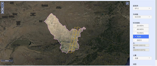
The system fast-view data includes satellite data such as HJ-1A, HJ-1B, Landsat-8, ZY-3, FY-2, GF-1, GF-2, and PROBA-V. The spatial resolution of the data varies from 1-300 meters, the revisit cycle varies from every half hour to one month.
The deployment and application of this system is like installing an “eye” in the sky, which can quickly grasp the near-real-time changes in the area, such as the occurrence and development of industrial accidents, illegal discharges, fires and floods, and form a rapid response capability ; also can use the data obtained at different times to carry out work in a certain area on the progress of project implementation, verification of illegal construction, and evaluation of planning effectiveness.
The system will provide key project planning and layout for the establishment of a national ecological civilization demonstration city in Ulan Chab City, monitor the implementation process and evaluate the construction effect, etc., and provide earth observation data at different scales. Meanwhile, it will also provide the quick response capability for the ecological environment supervision and protection.

Effect map of large-screen deployment of satellite fast-view data service system (Photo credit: CBCGDF)

Data query interface of satellite fast-view data service system of Ulan Chab (Photo credit: CBCGDF)

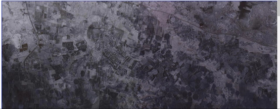
2.1-meter spatial resolution ZY-3 full-color (black and white) image in the area acquired by the system on January 3, 2020 (Photo credit: CBCGDF)
By / Maggie
